")
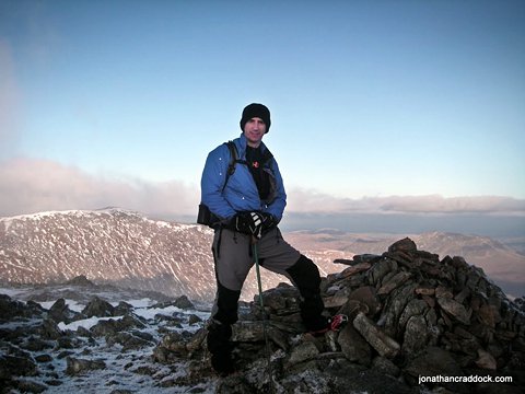
With everything else that has been going on recently (namely see photo below left) I'd failed to notice I'm now just over one year into my project to walk all 214 "Wainwrights" in the Lake District. So I thought I'd put together this brief summary of routes to date. The count stands at 67, spread over 13 day walks, and 1 wildcamp. I'd probably hoped to be a bit further forward at this stage, but aside from the arrival of Jack, we've also gutted and virtually rebuilt our house from the inside out. So I think progress is pretty good, and in any case, I'm not setting any kind of time limit on it.

A slight shift in priority was required, but still averaging more than one route per month!
The table below lists the routes so far. The titles are linked to my trip reports, giving full details of the walk and terrain, and where possible I have uploaded the GPX track-log. All the photos from each walk are available on my Picasa Web albums page, or via bit.ly/jc-214.
| Date |
Title |
Length |
Wainwrights |
GPX |
|
| 13th July 2011 |
Great End via Seathwaite Fell |
15km |
2 |
great_end.zip |
|
| 15th June 2011 |
|
23km |
6 |
martindale_meander_1.zip |
|
| 3rd/4th May 2011 |
Northern Fells Wildcamp and Partial Circuit |
30km |
6 |
nfcamp.zip |
|
| 20th April 2011 |
High Street via Stony Cove Pike |
19km |
6 |
high_street1.zip |
|
| 26th January 2011 |
Causey Pike via Knott Rigg |
12km |
4 |
causey_pike.zip |
|
| 15th December 2010 |
Dovedale Round |
13km |
5 |
dove_round.zip |
|
| 3rd November 2010 |
Haystacks via Red Pike |
16km |
4 |
haystacks.zip (*1) |
|
| 16th October 2010 |
The Coledale Round-about |
17km |
7 |
coledale_rev.zip |
|
| 6th October 2010 |
Grisedale Horseshoe Redux |
25km |
9 |
grisedale_redux.zip |
|
| 2nd October 2010 |
Dodd to Latrigg Loop |
25km |
6 |
dodd_latrigg.zip |
|
| 4th September 2010 |
Great Cockup Loop |
24km |
6 |
cockup.zip |
|
| 24th August 2010 |
Skiddaw Loop |
16km |
6 |
ullock_skiddaw.zip (*2) |
|
| 14th August 2010 |
Carrock Fell Loop |
20km |
4 |
carrock_knott.zip |
|
| 9th August 2010 |
Blencathra Loop |
16km |
4 |
blencathra_1b.zip (*3) |
I see from Google Analytics that visitors arrive on my website in fairly modest numbers, but most of the trip reports are getting a few hits each week - some more than others, so I hope they are proving to be useful and interesting to someone! Summit bagging is not without it's critics, but I have to say it has suited me very nicely, getting me to areas of Lakeland that I probably wouldn't have got around to visiting otherwise.
If I can match this progress in the next 12 months I'll be more than happy, and by that time should be well over half-way towards the full 214. Next update on my blog here will be the Great End trip report, including a somewhat frustrating #fail up Cust's Gully. On the subject of scrambling and climbing, if you feel so inclined, check out my other blog over at lifeontheledge.com.
Footnotes:
(*1) GPS battery ran out on Haystacks and at the time I wasn't geo-tagging photos, etc, so I didn't bother to change the battery to get the rest of the track-log saved. I descended to the west of Little Round How, crossed Warnscale Beck and then headed back to the carpark via Warnscale Bottom.
(*2) On this route, I lost my GPS. Reported it to the police, but it's either still up there somewhere, or whoever found it failed to hand it in - thieves!!! So for this walk the GPX is a route plan - I think fairly accurate.
(*3) No track-log was saved for this walk, so again, GPX file is a route plan. It's pretty accurate to the route I walked, but I'd suggest finding a different path up Souther Fell. This ascent was just a long slog through deep bracken, and it ought to be possible to follow a more natural line along the top of the ridge.
15 Feb 2020
Disqus currently not enabled on this page... Twitter
 Facebook
 Google+
 LinkedIn
 Soundcloud
 Flickr